Know Your Flood Risk.
CLICK HERE FOR

NEWPORT PD UPDATE!

A Newport Harbor waterfront homes Flood Risk Information and Education Company.

NOAA predicts a 7.0 king tide in 2026, and this year’s El Niño Kelvin wave could add up to 22 inches to it. This does not account for storm surge as we have recently seen.

We are here to help determine water points of entry, property risk and mitigation plans, to help protect your home.

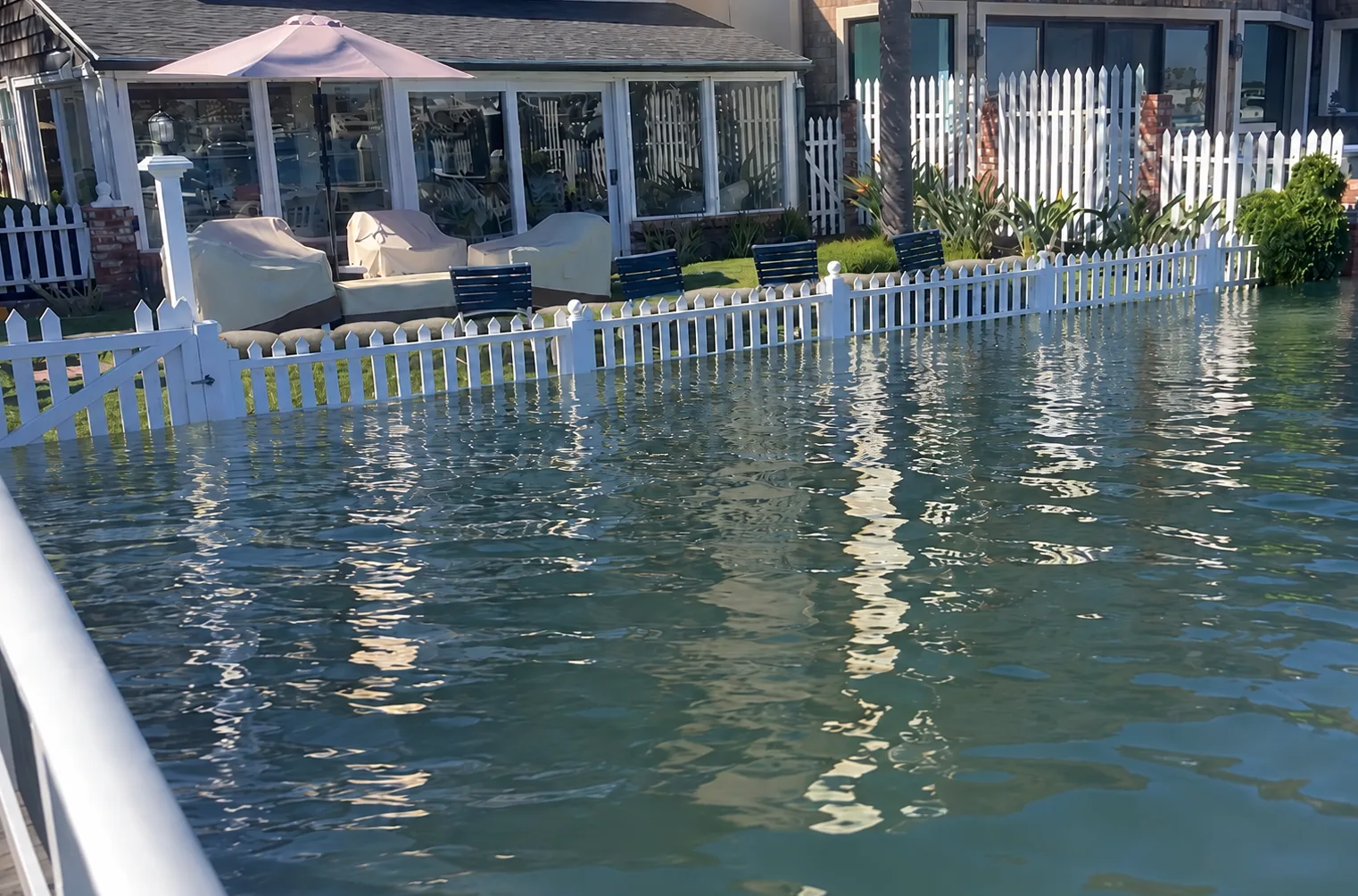
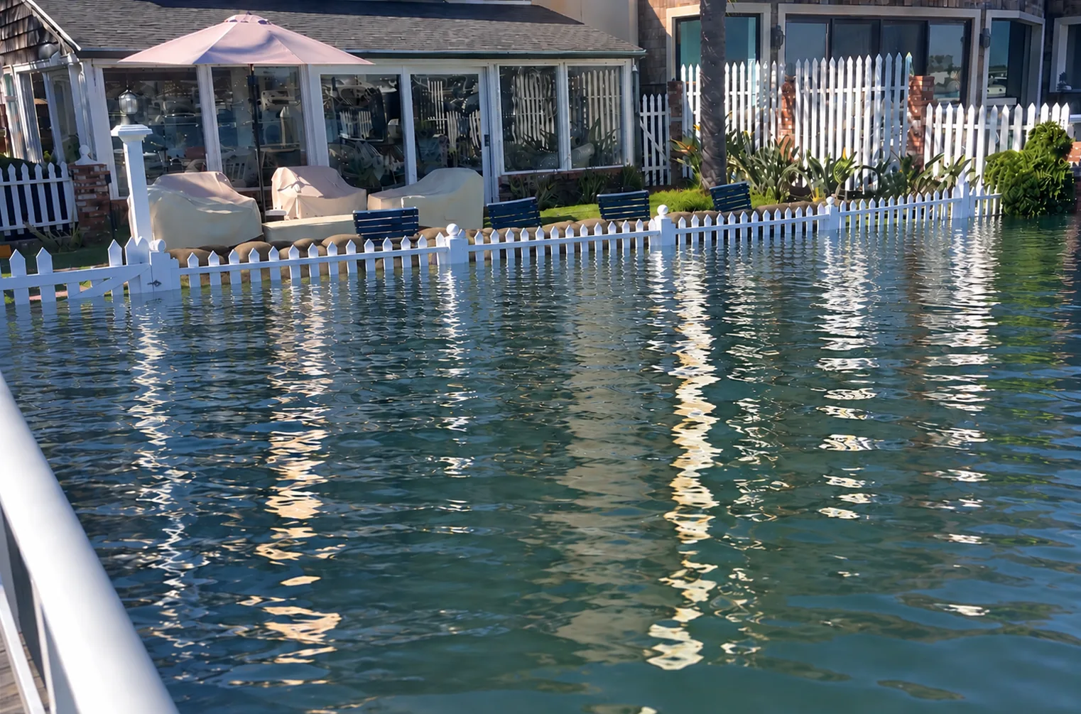
An 8-foot tide at a Newport Harbor home, held back by a sandbag barrier behind the fence
Oct 226.53′up to 7.53′ or more with Kelvin wave + Storm surge
Nov 256.89′up to 7.89′ or more with Kelvin wave + Storm surge
Dec 247.00′up to 8.00′ or more with Kelvin wave + Storm surge
Jan 226.83′up to 7.83′ or more with Kelvin wave + Storm surge

What Rising Tides Can Mean for Your Property

Even a few extra inches can determine whether water stays outside, or enters your home.

  1. Potential King Tide + Kelvin Wave(~7.5 to 8.8 ft)

    King Tides + Kelvin Wave predictions are up to an 8.8 foot tide. This does not account for storm surge.

  2. King Tide(~7.0 ft)

    Predicted to be about 7 feet in upcoming king tides.

  3. Normal High Tide

    Typical high tide levels in Newport Harbor.

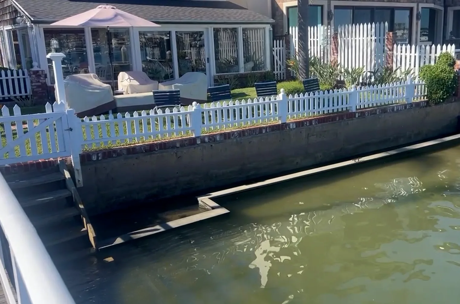
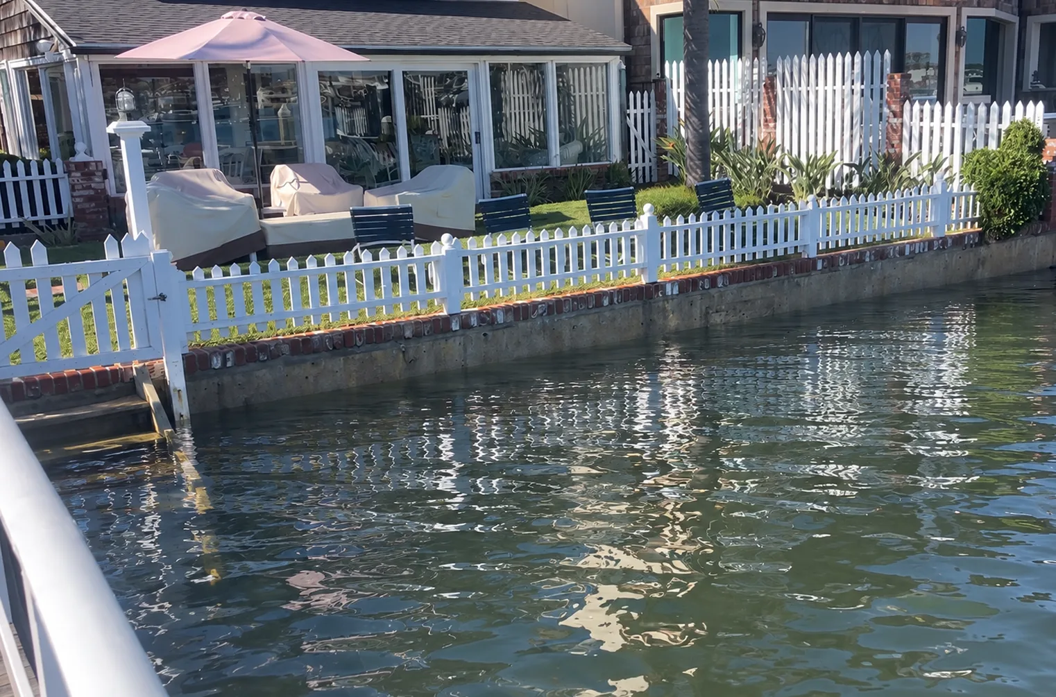
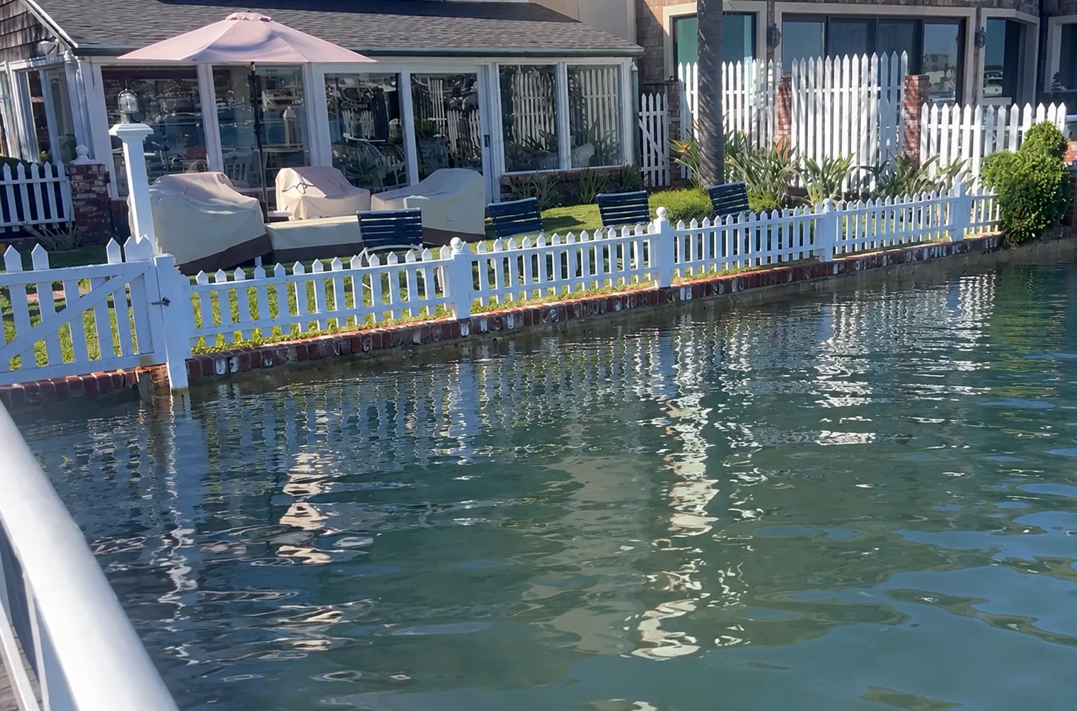
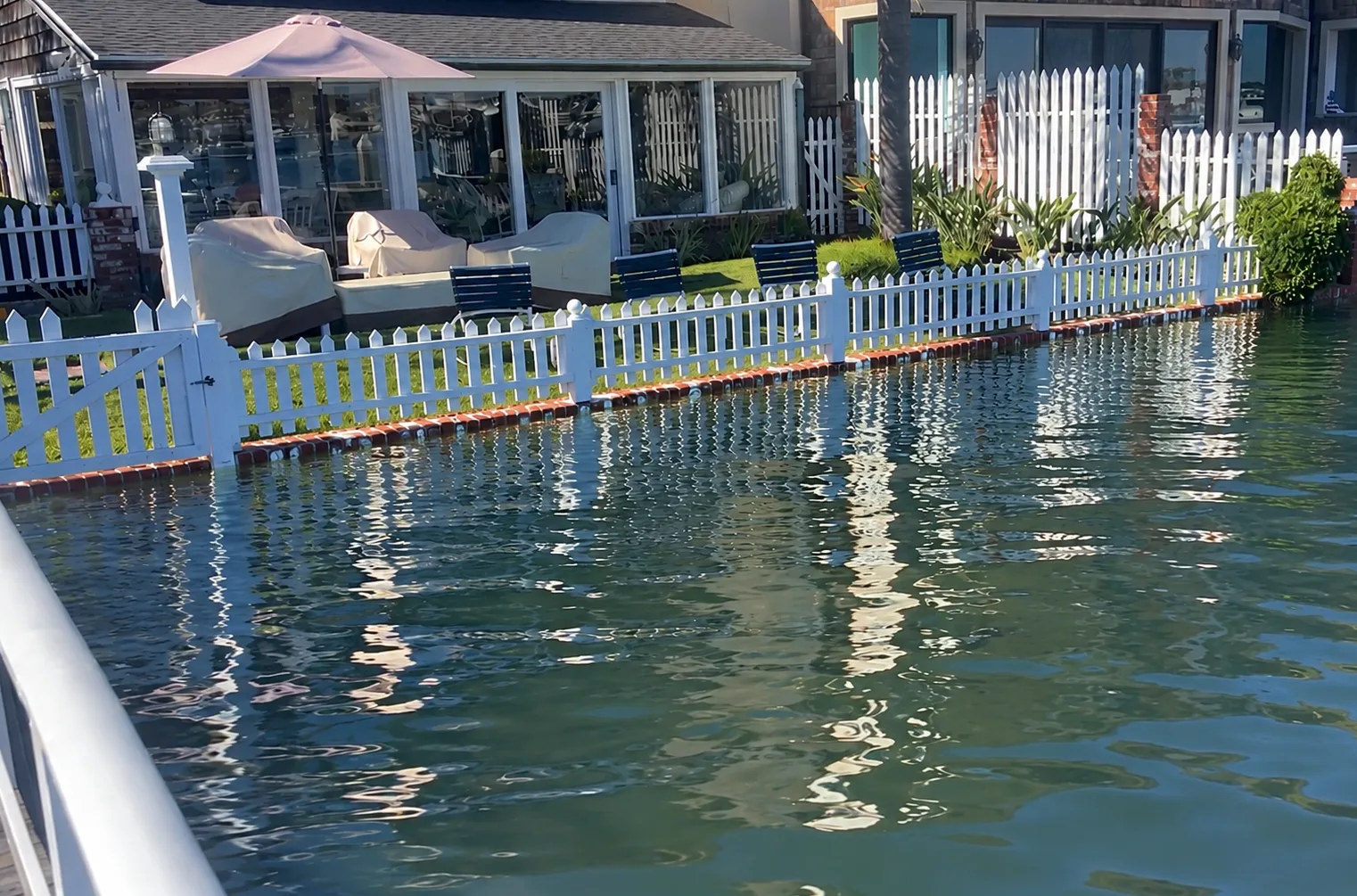
Normal tide at a Newport Harbor bayfront home Typical high tide at a Newport Harbor bayfront home 6.7 foot tide at a Newport Harbor bayfront home 7.0 foot tide at a Newport Harbor bayfront home 7.5 foot tide with 1 sandbag layer at a Newport Harbor bayfront home 8.0 foot tide with 2 sandbag layers at a Newport Harbor bayfront home Normal tide

A typical day on the harbor. The full face of a seawall and sandy beach are showing. King Tides + Kelvin Wave predictions are up to an 8.8 foot tide, without accounting for storm surge.

Every property floods at a different height. Find out where yours does before it's to late.

Schedule a consultation

Photos are from the TideSafe demo at a Newport Harbor home. Tide heights are in feet and tenths above MLLW.

Watch the demo

How we are planning to hold back the harbor.

Our demo at a Newport Harbor home walks through each rising tide level and sandbag protection it takes to keep the water out.

Why TideSafe exists

For 38 years, my parents have lived on Newport Harbor and have experienced countless high tides.

During the July 13, 2026 king tide, the predicted tide was 7.16 feet and it caused flooding and damage to some bayfront homes. High tides are predicted in October. King tides are expected in November, December, and January. The highest of these is predicted to be about 7 feet.

If the current Super El Niño Kelvin wave raises background sea levels by another 22 inches, conditions could approach an 8.8 foot tide scenario on December 24. We are taking steps now to protect their home with a 15-inch sandbag barrier. Sandbags are not the only form of protection. We are happy to share what we know about all flood mitigation methods

This experience is why we started TideSafe: to help other waterfront homeowners understand their flood risk and prepare before extreme high tides arrive.

Brett, Founder
Choose Your Property Assessment

Expert guidance to help protect your waterfront property. Three levels of assessment, depending on what you already know about past high tides on your property.

On-Site Flood Risk Discussion

For homeowners who want an expert walkthrough and practical next steps

$300

  • Property investigation and overview
  • Discussion regarding what to consider for your home
  • Seawall conditions
  • Drainage and other water access point risks
  • Protection recommendations: sandbags, pumps, water barriers, plugs
  • Ingress concerns from neighboring properties

Assistance understanding your home’s flood risks.

Choose this assessment

Property Elevations Assessment and Discussion

For properties where high tide elevations are known

$800

  • Measure and document key elevations on your property
  • Identify how high water reached during previous high tides
  • Show where future high tides could reach (example: 7–8 feet)
  • Provide a summary of property critial elevations

Better understand where water could enter your property so you can plan the right protection.

Choose this assessment

Certified Surveyor Elevation Report and Discussion

Required for properties where high tide elevations are unknown

$3,100

  • Includes all of the above, plus a certified surveyor elevation survey
  • Site map with elevations
  • Analysis of current and future high tide impacts
  • Forms of permanent and temporary flood protection
  • May be used for long-term planning

The most complete picture of your property’s flood exposure.

Choose this assessment

How it works

Simple for you. Precise where it counts.

  1. 01

    Request an assessment

    Tell us about your property and what you’ve seen during past high tides. We’ll confirm which assessment fits and schedule a visit.

  2. 02

    We can survey your property

    Measure and document the elevations that matter: seawall cap, yard, patio, thresholds, utilities, and other areas with potential for damage.

  3. 03

    You get a detailed elevation report.

    Education on critical potential flood concerns.

Request an assessment

Peace of mind is just an assessment away.

Tell us about your property. We’ll reply within one business day to confirm the right assessment and set a time to visit.

Call
949-791-2121
Email
service@tidesafe.net

Questions

What waterfront owners ask us

What is a king tide?

King tides are the highest tides of the year. They happen when the moon is closest to the Earth and lined up with the sun. In Newport Harbor they arrive in the winter months, usually in the morning. They’re predictable years ahead, which means you can prepare.

What is a Kelvin wave, and why does it matter this year?

A Kelvin wave is a large, slow swell of warm ocean water that travels along the equator and then up the West Coast. It’s linked to the strengthening El Niño. It raises the average sea level for weeks or months, so every tide sits higher than NOAA’s standard predictions. Scientists and news reports estimate an extra 6 to 12 inches along the California coast this season.

Which assessment do I need?

If you want an expert to walk your property, check the seawall and drainage, and recommend protection, start with the $300 On-Site Flood Risk Consultation. If you’ve seen where past high tides reached on your property (a water line on the seawall, a flooded patio, photos), the $800 Property Elevations Assessment measures and documents your key elevations. If you don’t know, choose the $3,100 Certified Surveyor Elevation Report, which includes a certified surveyor’s elevation survey and site map.

How soon can you come out?

We schedule assessments in the order that we receive requests. We anticipate that our calendar will fill quickly. Please reach out as soon as possible.

Call Schedule a consultation